Indufor’s extensive experience in forest due diligence and valuation highlights the importance of reducing uncertainty around forest area, age class, species, yield and spatial distribution when assessing plantation investments.
ForestInsights brings together Indufor’s expertise in remote sensing, forest modelling and valuation to provide a detailed picture of planted forest resources.
Satellite imagery, spatial analysis and modelling are used to develop GIS data layers describing plantation boundaries, species composition and stand age.
These data can then be combined with information on forest yields, costs and pricing to assess future harvest volumes, wood availability, transport requirements and investment opportunities for individual assets, regions or national plantation resources.
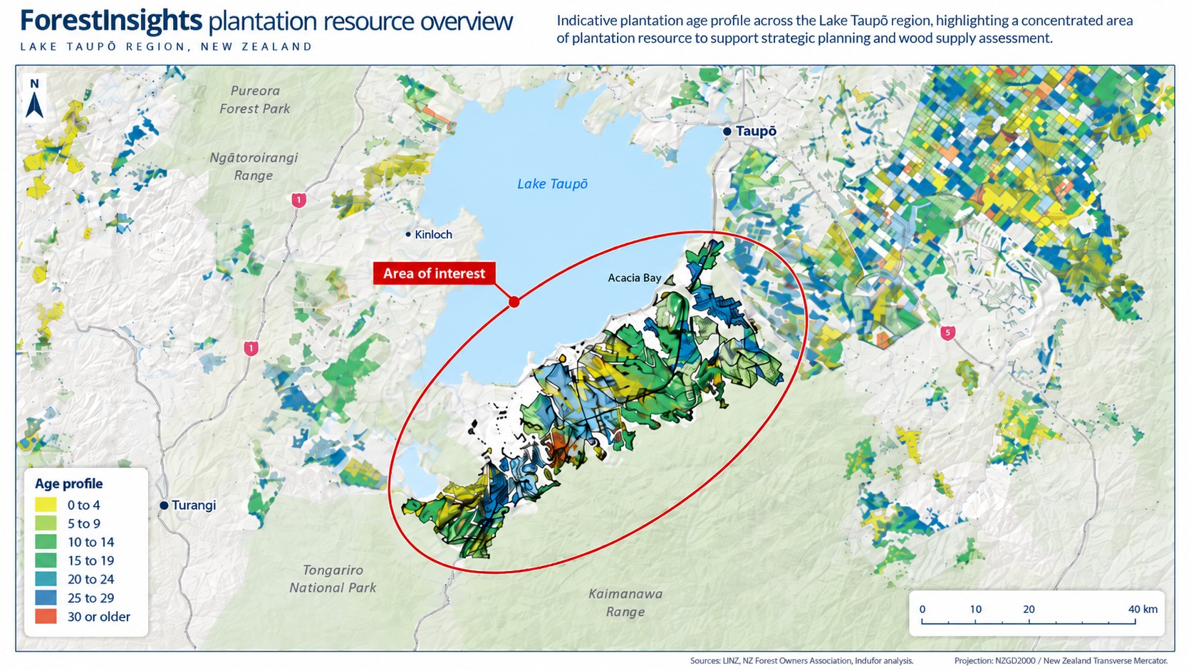
The resource can also be updated over time. As forests are harvested and replanted, or affected by events such as fire, storms or other disturbances, new satellite imagery can be used to update the underlying forest information and maintain a current picture of the resource.
For investors and forest owners, ForestInsights provides a rapid way to understand an asset, region or wood basket. The information can be used to assess:
- the location and extent of planted forests;
- age-class and species composition;
- the distribution and size of forest holdings;
- areas approaching harvest;
- proximity to processing facilities, infrastructure and markets; and
- likely transport distances and wood supply scenarios.
By applying our experience in forest modelling and valuation, the team at Indufor can use these data to develop regional or asset-specific wood availability forecasts and support due diligence, acquisition strategy, market analysis and longer-term forest planning.