ForestInsights combines AI and satellite data to deliver spatial forest intelligence. Our data layers map forest boundaries, stand age, and harvest history—helping decision-makers and investors assess opportunities, understand wood supply dynamics, and refine strategies.
How is ForestInsights different?
Plantation forests are dynamic and constantly changing, making it difficult to keep information current. National forest statistics often provide only static snapshots and tend to reflect the holdings of large forest owners more accurately than those of smaller growers. These data are updated infrequently and often lack detail, such as species composition or age-class distribution. ForestInsights overcomes these limitations by providing high-resolution, spatially explicit, and frequently updated data – offering a more comprehensive and current view of plantation forests.
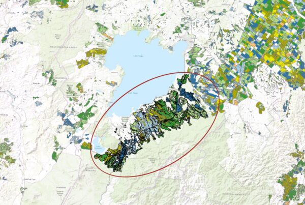
Data Coverage
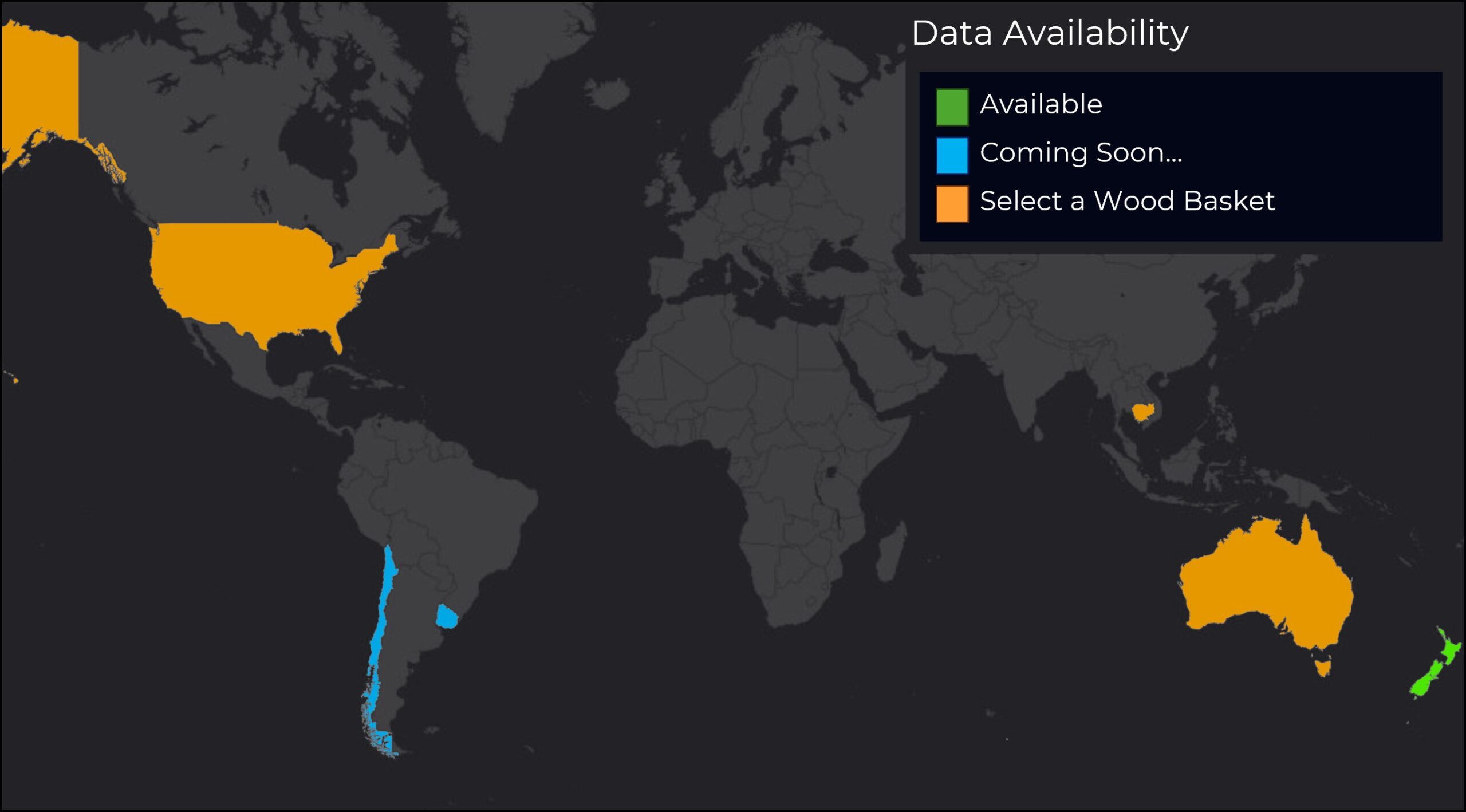
Coverage includes New Zealand and selected regions of Chile and Uruguay, with the option to commission a wood basket to support specific analyses in additional designated countries.
Visit ForestInsights | Dwell to access available datasets.
What Questions does ForestInsights help answer?
The spatial intelligence provided by ForestInsights helps analysts to quickly understand a region or wood basket by answering critical questions, such as:
- Where are plantations located?
- What is the age profile?
- What area is ready for harvest?
- How far are they from processing facilities?
- Where are small forest holdings located, and how accessible are they?
ForestInsights reduces uncertainty and empowers decision-makers, policymakers, and investors to evaluate opportunities more effectively, gain deeper insights into wood supply dynamics, and develop informed policies and strategies.
Contact our Indufor Asia Pacific office for more information.