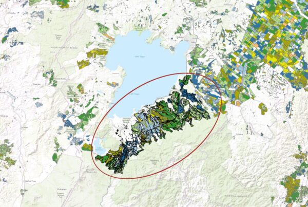
The conservation of remnant native woodlands and wetlands is a shared priority for agencies seeking to enhance biodiversity and protect critical habitats. Achieving this, however, requires accurate monitoring and reporting across numerous small, often remote areas—many located on private land—making it a complex and resource-intensive task.
To help address this challenge, Indufor, in partnership with regional authorities, has developed a monitoring framework for continuous oversight of Significant Natural Areas (SNAs). By leveraging high-frequency satellite imagery accessed from the cloud, the system enables rapid and precise detection of small and scattered land-cover changes.
At the core of this framework is Indufor’s automated alerts system, which systematically monitors each SNA for signs of change. To maximise efficiency, SNAs are subdivided into a network of hexagons that are independently analysed whenever new satellite imagery becomes available. When changes are detected, the system generates a date-stamped alert, plots it on a vegetation health index timeline, and pushes it to Indufor’s interactive online dashboard—Dwell, for review.
Users can then assess, share, and decide on further action, with alerts delivered either in batch mode or near real-time depending on operational needs.
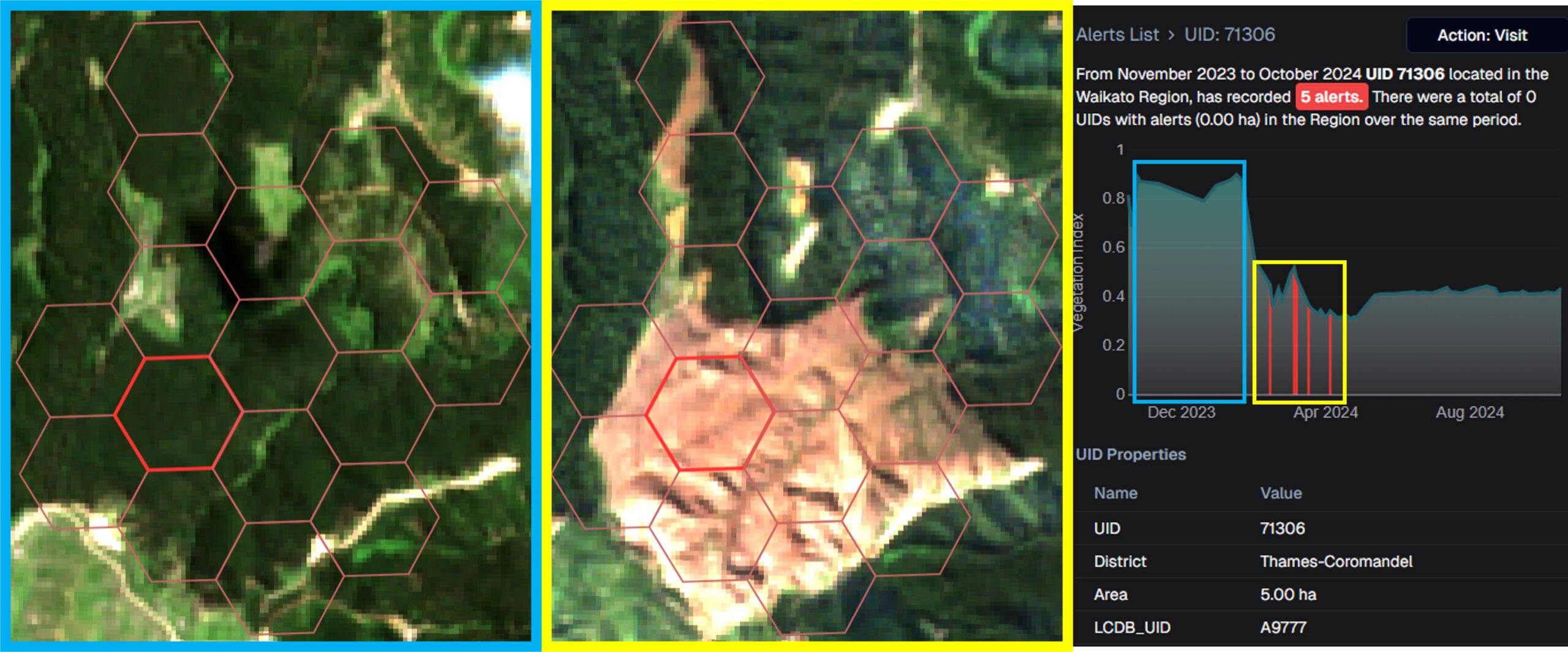
This automated approach streamlines large-scale monitoring by providing pre-processed, spatially discrete alerts—eliminating the need for time-consuming manual image searches. Alerts remain permanently available on the Dwell dashboard, where reviewers can classify and share them. By interacting with a graphed alert, users can overlay before-and-after Sentinel-2 imagery on a regional map for deeper analysis—supporting faster, evidence-based decision-making.
Visit Dwell to see the platform in action or contact our Asia Pacific team to learn more about how the platform can support your monitoring goals.